Green on brown: precision spray mapping for post-harvest cotton
Near Whitton a cotton grower finishes their harvest and stubble burn. Their cotton paddock is looking empty. What remains is problematic; volunteer cotton, grasses pushing through and general weed pressure.
These stand out clearly in a recently burned field, green on brown. The grower wants to make the most of this opportunity to accurately see where the problems were.
With 160 hectares of harvested cotton country to treat he wanted to take out the guess work. He wanted a precision spray map he could load into his John Deere sprayer, so he could know exactly where to treat and avoid wasting product.
The challenge
Post-harvest cotton paddocks present a narrow treatment window. Once the crop is off and the stubble burned, conditions are often ideal for a targeted knockdown. But the window is small as weed pressure escalates. The grower needed to act fast and be accurate.
Blanket treatment across a large area is a common option, but it’s an expensive one. Treating the entire block, including where treatment is not needed can waste product. And at post-harvest rates it can add unnecessary cost.
The grower's John Deere sprayer was already capable of running a variable rate prescription via ISOxml. He wanted to be smart in his approach and have an accurate map of where to treat.
Platform: DJI Mavic 3 Multispectral + DJI RTK-2
Imagery: RGB orthomosaic
GSD: 1.5cm
Software: Pix4D Fields (in-field processing)
Area imaged: 160Ha
Targets identified: Small-bladed grasses, residual cotton volunteers, general broadleaf weeds
Output: Spray prescription map (.shp and ISOxml)
Integration: John Deere sprayer (direct ISOxml import)
Turnaround: Same day — imagery and spray map completed within hours of flight
Imaging
We flew the 160 hectares with the DJI Mavic 3 Multispectral paired with a DJI RTK-2 base station. While coarser GSD can blur small bladed grasses into background noise, we captured RGB imagery at 1.5cm ground sampling distance. This meant we could clearly distinguish grasses from bare soil and burnt stubble.
With the living green vegetation in contrast to the brown bare ground, RGB was the right choice for this job. This was effective enough without needing to run the full multispectral analysis.
The RTK-2 provided centimetre-accurate positioning. This precision mapping is essential for a sprayer that is moving through the paddock.
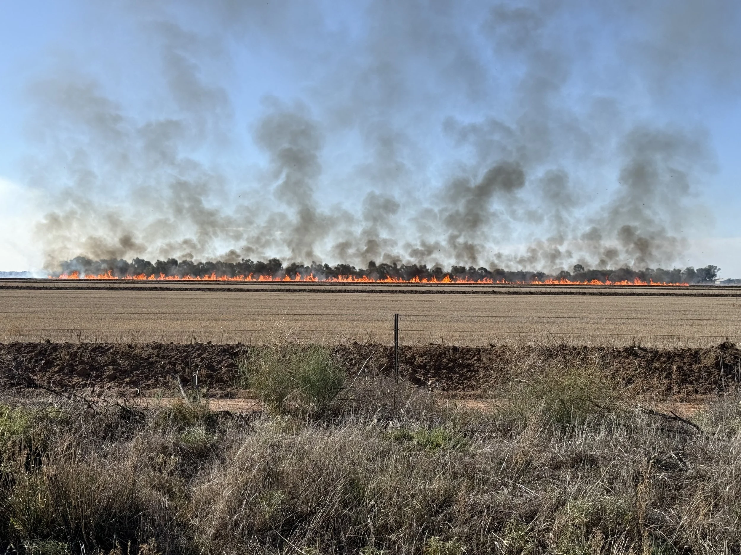
Stubble burning near Whitton.
Processing and output
We did all processing in the field using Pix4D Fields. We built the orthomosaic and worked up the weed identification layer on-site. We avoided needing to send data back to an office and waiting on turnaround and were able to create a prescription map within hours of completing the flight.
We exported the spray map in both shapefile (.shp) and ISOxml formats.
We could load the ISOxml directly into the client’s John Deere terminal. There was no conversion, third-party software, or manual re-entry of boundaries. He had a ready-to-use prescription before the day was out.
Results
We mapped, processed and delivered a spray prescription within a day and were able to give the grower:
· exact treatment areas
· confirmed weed locations
· a file that fed into existing equipment, with no hardware or workflow changes needed
This meant he could target areas with weed pressure and apply product only where needed. The precision map also serves as a baseline record. It is useful when evaluating what worked and planning for spraying next season.
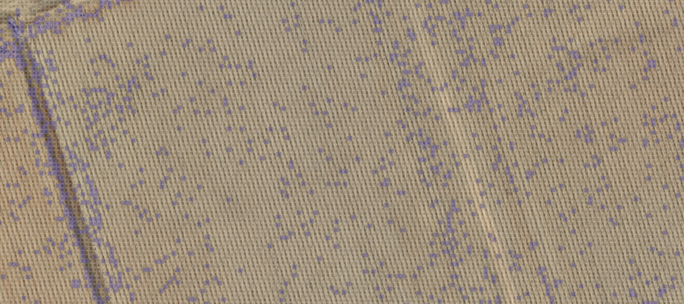
Prescription spray map generated in Pix4D Fields
Get in touch
We can map and deliver prescription files in ISOxml and shapefile formats. These are compatible with various leading farm management platforms, including John Deere Operations Centre and Trimble.
If you're running irrigated cropping and want to make your sprayer smarter, get in touch.